 The propaganda map is used to convey a political message through the use of symbols, images and geography. This map is from WWI and shows the opposing countries at war. It is effective because it not only shows who is fighting proximity wise, but also instills preconceived notions by the use of negative imaging.
Thursday, August 28, 2008
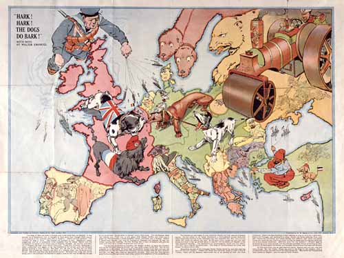
Propaganda Map
The propaganda map is used to convey a political message through the use of symbols, images and geography. This map is from WWI and shows the opposing countries at war. It is effective because it not only shows who is fighting proximity wise, but also instills preconceived notions by the use of negative imaging.
Subscribe to:
Post Comments (Atom)

No comments:
Post a Comment