skip to main
|
skip to sidebar
Maps
Sunday, September 14, 2008
Isotach
Isotachs
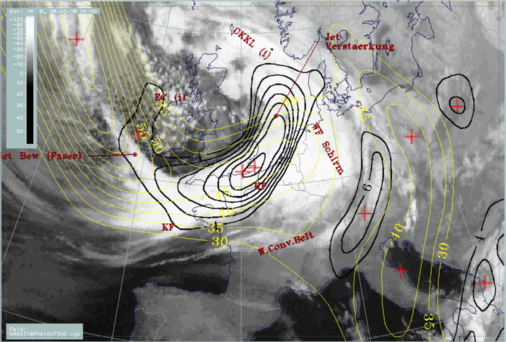
are maps showing wind speeds. They do this with lines; speeds of equal measurement being enclosed. This is an
isotach
map showing the associated weather front causing the winds that are displayed.
No comments:
Post a Comment
Newer Post
Older Post
Home
Subscribe to:
Post Comments (Atom)
Blog Archive
▼
2008
(54)
►
October
(18)
▼
September
(31)
Triangle Plot
Index Value Plot
Scatterplot
Climograph
Windrose
Population Profile
Bilateral Graph
DOQQ
DEM
DLG
DRG
Isopleth
Isopach
Isohyet
Isotach
Infrared Aerial Photograph
Isobar Map
LIDAR
Cartographic Animation
Statistical Map
Cartogram Map
Doppler Radar
Isoline Map
Proportional Circle Map
Choropleth Map
Hypsometric Map
Topographic Map
Dot Distribution Map
Black & White Aerial Photo
Planimetric Map
PLSS Map
►
August
(5)
About Me
JSellers
View my complete profile
 Isotachs are maps showing wind speeds. They do this with lines; speeds of equal measurement being enclosed. This is an isotach map showing the associated weather front causing the winds that are displayed.
No comments:
Post a Comment